|
||
|
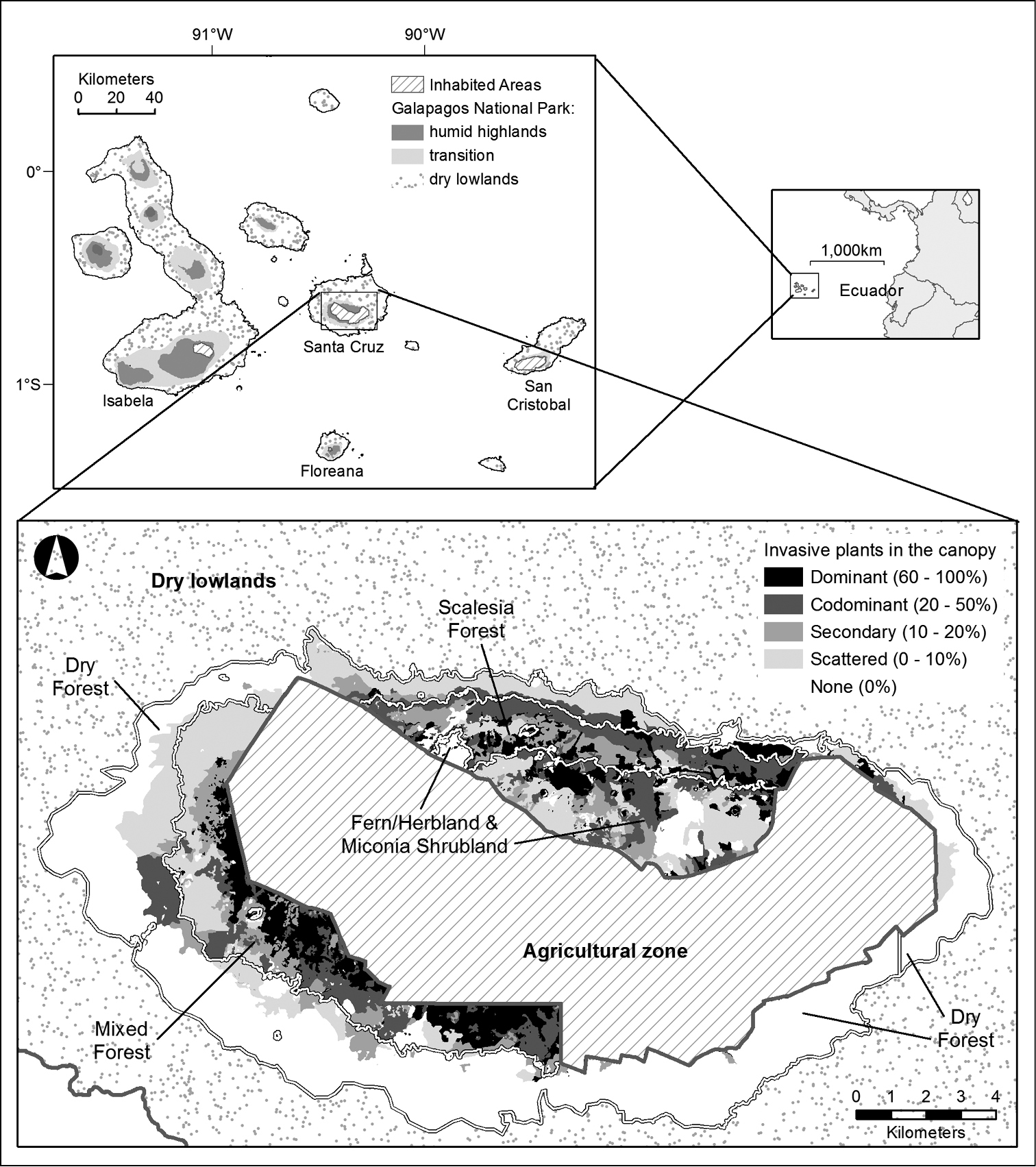
Location of the study area and density of invasive plants in the canopy. The upper map shows the location of the study area, spanning the humid highlands of Galapagos National Park, Santa Cruz Island. Climatic zones are indicated and the four islands inhabited by people are labelled; each of these is inhabited only in an agricultural zone in the highlands and a small coastal town in the lowlands. The lower map shows the density of invasive plants in the canopy of the study area, as indicated by shading. Co-dominant invasive species may be present with either invasive or native plants. Historical vegetation types are outlined and labelled. Of these the Dry Forest occurs on the periphery of the humid highlands that is transitional to the dry lowlands. |