|
||
|
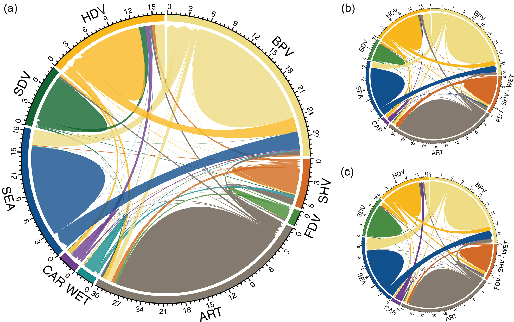
Chord diagrams for: a all coastal tracts b tracts with Carpobrotus spp. expansion (EXPCAR) and c tracts with Carpobrotus spp. reduction (REDCAR). The chord diagrams summarise the percentage (%) of each land-cover class in T0 (outer ring) that changed into another class to T1. The size and the direction of arrows represent transitions to other classes in T1. For example, an increase of HDV from BPV in T1 considering all coastal tracts. The proportion (%) of each land-cover class that remained stable over time is represented by the internal coloured circle. Land-cover classes: artificial areas (ART), beach with pioneer annual vegetation (BPV), herbaceous dune vegetation (HDV), shrub dune vegetation (SDV), Forest and woody dune vegetation (FDV), semi-natural herbaceous vegetation (SHV), wetland (WET), Tyrrhenian sea (SEA), Carpobrotus spp. (CAR). |