|
||
|
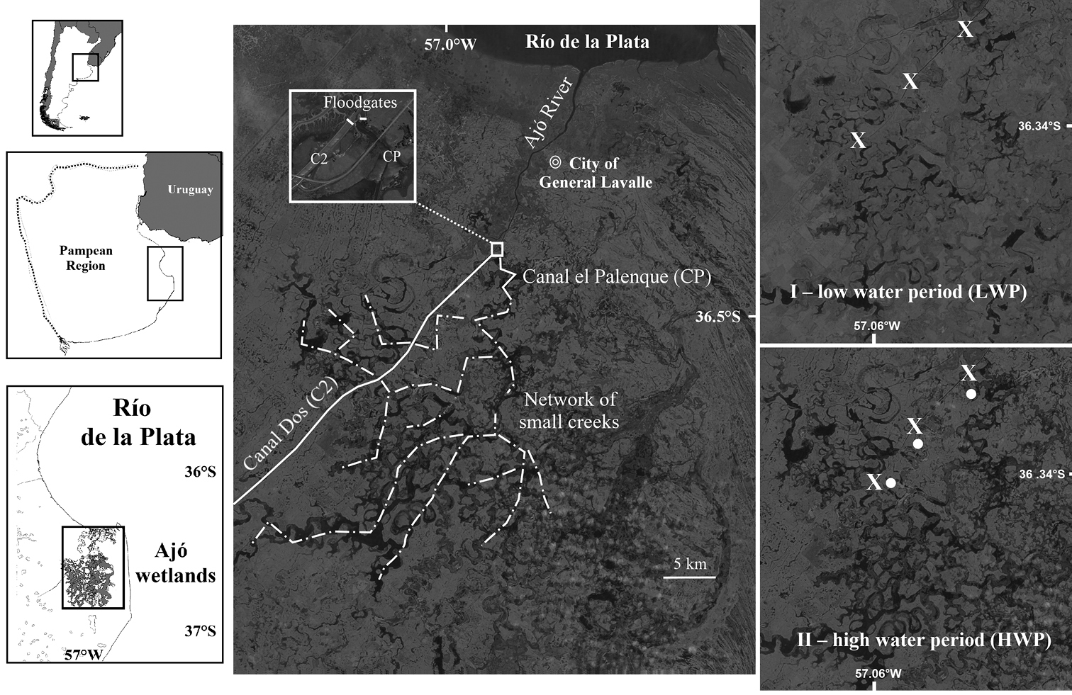
Geographical location of the Ajó wetlands in the Pampean region, indicating the main water courses: Ajó River, Canal Dos, Canal el Palenque (with detail of their respective flood gates) and the main streams of the network of small creeks. Satellite images from the Ajó wetlands during two contrasting hydrological scenarios: I low water period (LWP), sampling sites in Canal Dos (X) II high water period (HWP), sampling sites in Canal Dos (X) and the network of small creeks (white circle). |