|
||
|
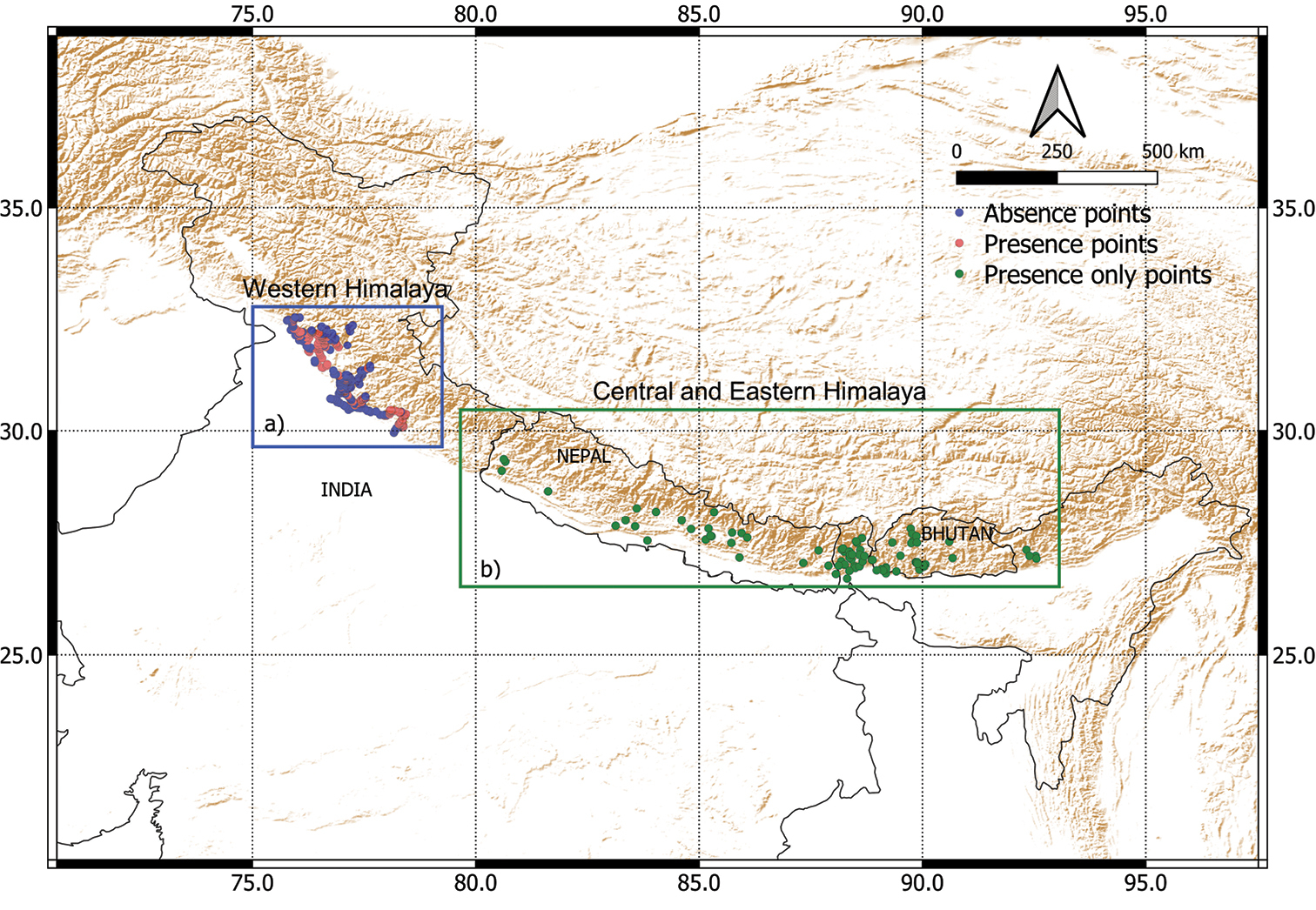
Survey locations of Ageratina adenophora. The region marked by the blue rectangle a shows the survey area in the Western Himalaya from which 192 presences (red circles) and 197 genuine absences (blue circles) were used to train the model. The region marked by the green rectangle b shows the Central and Eastern Himalaya from where an additional set of 85 presence only locations (green circles) were obtained for evaluating the transferability of the species distribution models trained in the Western Himalaya.The relief map of the region is depicted in brown. The relief map was made with layer obtained from Natural Earth and the international borders were digitized from political map of India (9th edition) published by survey of Inida.. |