|
||
|
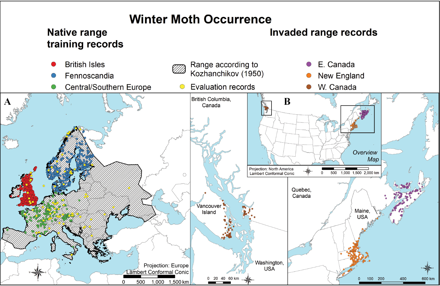
A map showing the distribution of the native range for winter moth (Operophtera brumata), recreated from Kozhanchikov (1950), as well as native winter moth occurrence records used as training records – colored according to three geographic filters (British Isles in red, Fennoscandia in blue and Central/Southern Europe in green) and evaluation records shown in yellow B map of North American records reflecting the invaded range separated into three geographic regions (western Canada in brown, New England in orange and eastern Canada in violet). |