|
||
|
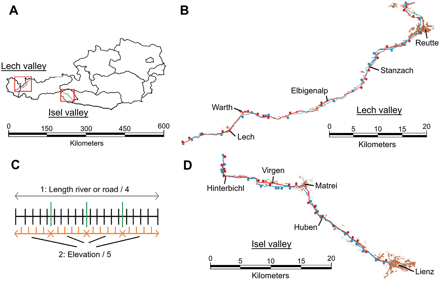
Locations of the study regions and distribution of transects along both rivers and roads. A the Lech valley makes up part of the federal states Tyrol and Vorarlberg. The Isel valley is located in the eastern part of Tyrol (“Osttirol”) B topographical map of the river (blue) and road (red) with larger towns and built-up areas (brown) in the Lech valley. Points indicate the positions of transect C illustrated here is the method applied to distribute 20 transects along each river and road. First, the total length of each river and road was divided into four equal sections (green). Secondly, the elevational range of each section was divided into five equal-elevation parts (orange). The center of each part subsequently determined the position of each transect (black), with the exemption of the lowest and highest transects that were placed on the end points of each river and road D same as in panel B but for the Isel valley. |