|
||
|
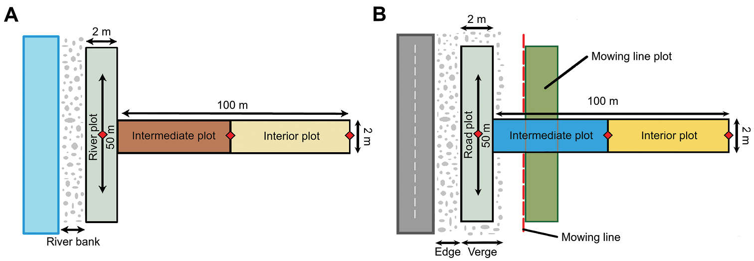
Study design illustrating the layout of the river (A) and road (B) transects. All plots had a size of 50 m × 2 m. The measurement points for the coordinates of each plot are visualized by a red rhombus. A the river plot was positioned at the line where 50% of the surface of the riverbank was covered by herbaceous species. The riverbank width was the area which was covered in gravel and had very little or no vegetation B the road plot was positioned adjacent to the non-vegetated road edge at the road verge. The road verge was characterized by the first occurrence of vegetation. To quantify the effect of mowing, a plot was established directly beyond the mowing line (i.e. in the first unmown vegetation). The mowing line plot followed the same orientation as the road plot. |