|
||
|
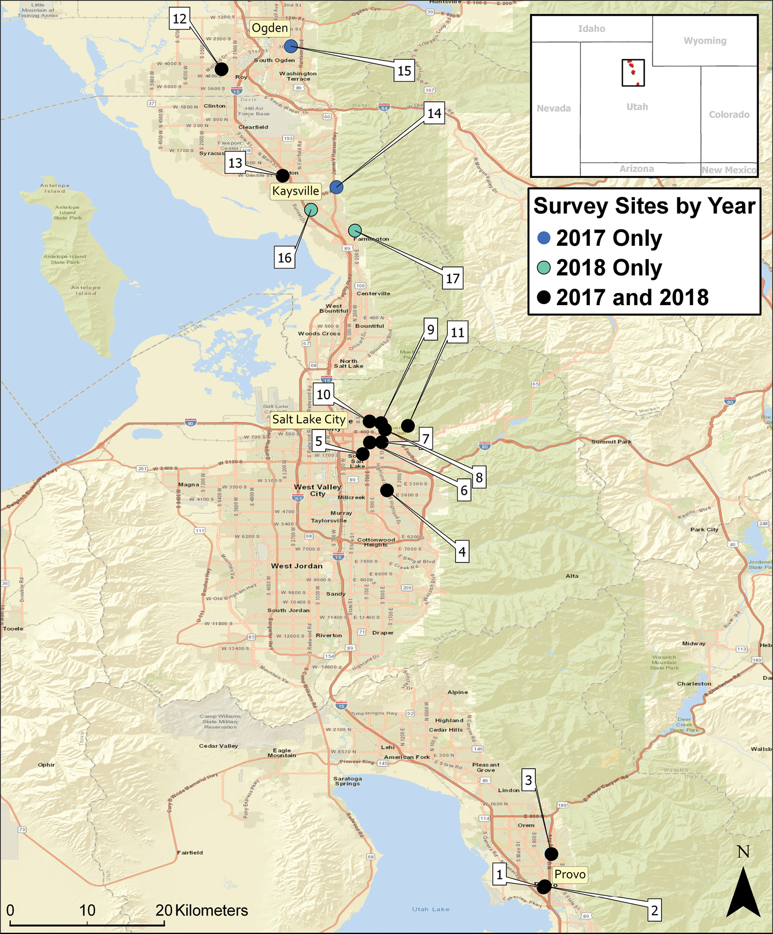
Map of 17 host plant survey sites in northern Utah, 2017 and 2018. Black dots represent sites that were visited in both years, blue dots represent sites visited only in 2017 and turquoise dots represent sites visited only in 2018. Geographical coordinates are as follows: Site 1: 40°13'44.7"N, 111°39'56.2"W; Site 2: 40°13'49.9"N, 111°39'50.6"W; Site 3: 40°16'05.2"N, 111°39'22.6"W; Site 4: 40°41'33.6"N, 111°50'53.8"W; Site 5: 40°44'06.4"N, 111°52'35.9"W; Site 6: 40°44'55.0"N, 111°52'05.8"W; Site 7: 40°44'56.1"N, 111°51'15.8"W; Site 8: 40°45'49.1"N, 111°51'02.1"W; Site 9: 40°46'16.5"N, 111°51'18.6"W; Site 10: 40°46'23.4"N, 111°52'07.1"W; Site 11: 40°46'04.8"N, 111°49'25.8"W; Site 12: 41°11'03.7"N, 112°02'29.2"W; Site 13: 41°03'35.9"N, 111°58'12.3"W; Site 14: 41°02'48.1"N, 111°54'26.2"W; Site 15: 41°12'40.3"N, 111°57'37.8"W; Site 16: 41°01'13.0"N, 111°56'13.1"W; and Site 17: 40°59'45.5"N, 111°53'08.5"W. |