|
||
|
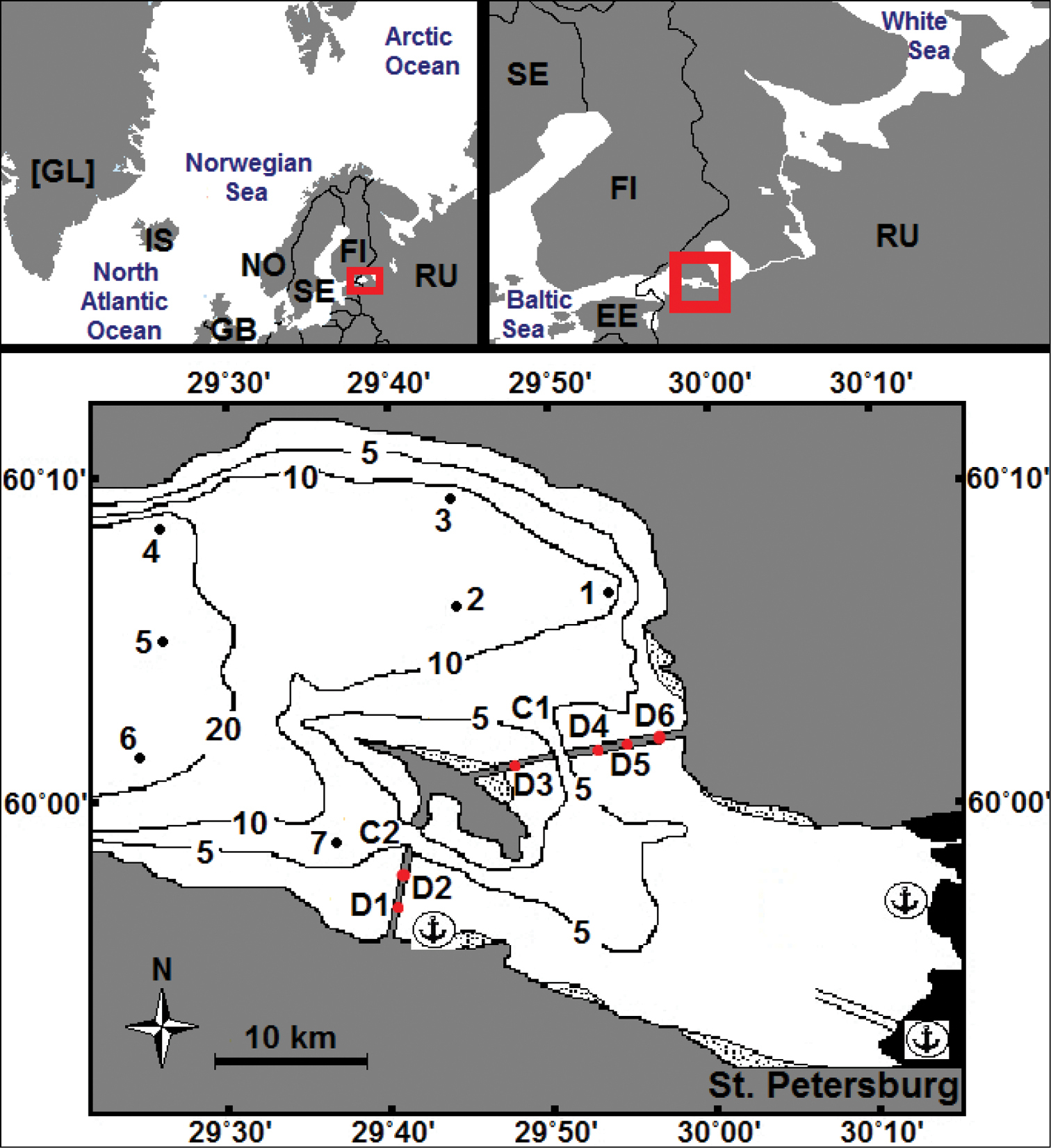
The upper and middle parts of the Neva Estuary with indication of sampling stations (1–7). Black lines: isobaths of 5, 10 and 20 m. Areas with dots indicate dense reeds. C1, C2 – gates for vessels; D1–D6 – waters gates in the St. Petersburg Flood Protection Facility. Anchor marked passenger and cargo ports. Red rectangles – the location of the Neva Estuary. Two-letter country codes are given according to ISO 3166-1 alpha-2 (ISO 2021). |