|
||
|
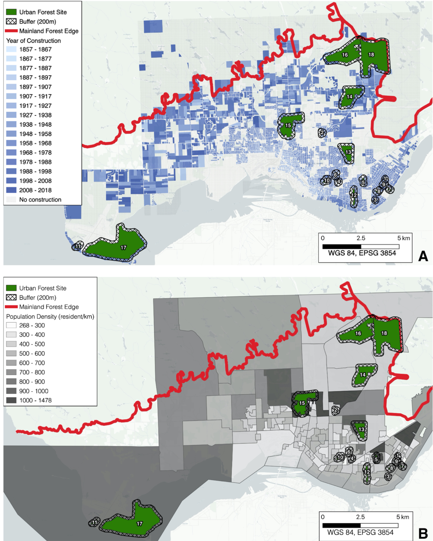
Map (i.e., WGS84 projection) of the 18 urban forests in Sault Ste. Marie, Ontario, Canada, in which this study is based. Both maps contain a representation of each urban forest, site 1 through 18, in green with a 250 m buffer beginning at the edge of the forested area and the unfragmented forest edge in red A the year of construction of all the plots with some development is indicated as a blue gradient B the population density of each neighborhood is indicated as a gray gradient. |