|
||
|
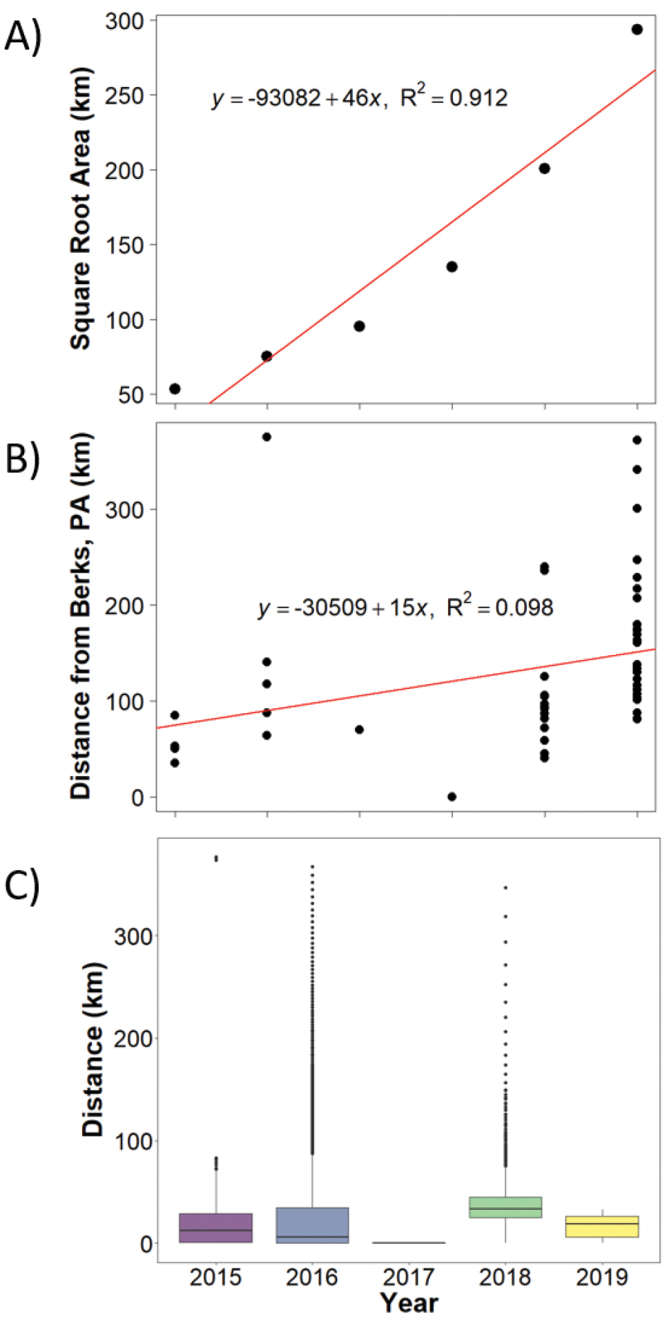
Estimated radial spread rates of spotted lanternfly (SLF) A plot of the square root cumulative county area containing SLF establishments divided by π by year of establishment. The slope of the regression is estimated at 46 km per year, providing an estimate of radial spread B plot of distance from the centroid of the county with the first SLF detection point (Berks County, PA) by year of establishment. The slope of the regression is estimated at 15 km per year C boxplots of boundary displacement distances between years of establishment, with average across all years of 38 km per year and median across all years of 21 km per year. |