|
||
|
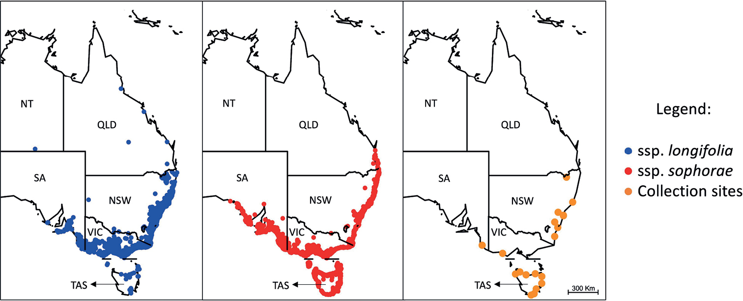
Maps of the native range distribution of Acacia longifolia. Distributions of A. l. ssp. longifolia and A. l. ssp. sophorae are presented in blue and red, respectively, and the sample collection sites of this study are presented in orange. Each orange dot represents the exact location of each collection site (see Table 1). Maps were drawn using the maptools R package (Lewin-Koh et al. 2011; R Core Team 2016). Geo-referenced occurrence records for each subspecies were obtained from the Atlas of Living Australia database (ALA 2021a, b) and the Global Biodiversity Information Facility (GBIF 2021a,b), with duplicates and erroneous records (i.e., records with coordinates that fell in the ocean or with no registered coordinates) manually removed in R statistical environment (R Core Team 2016) with the maptools, raster (Hijmans and van Etten 2010) and rgdal (Keitt et al. 2010) R packages. NSW: New South Wales. NT: Northern Territory. QLD: Queensland. SA: South Australia. TAS: Tasmania. VIC: Victoria. |