|
||
|
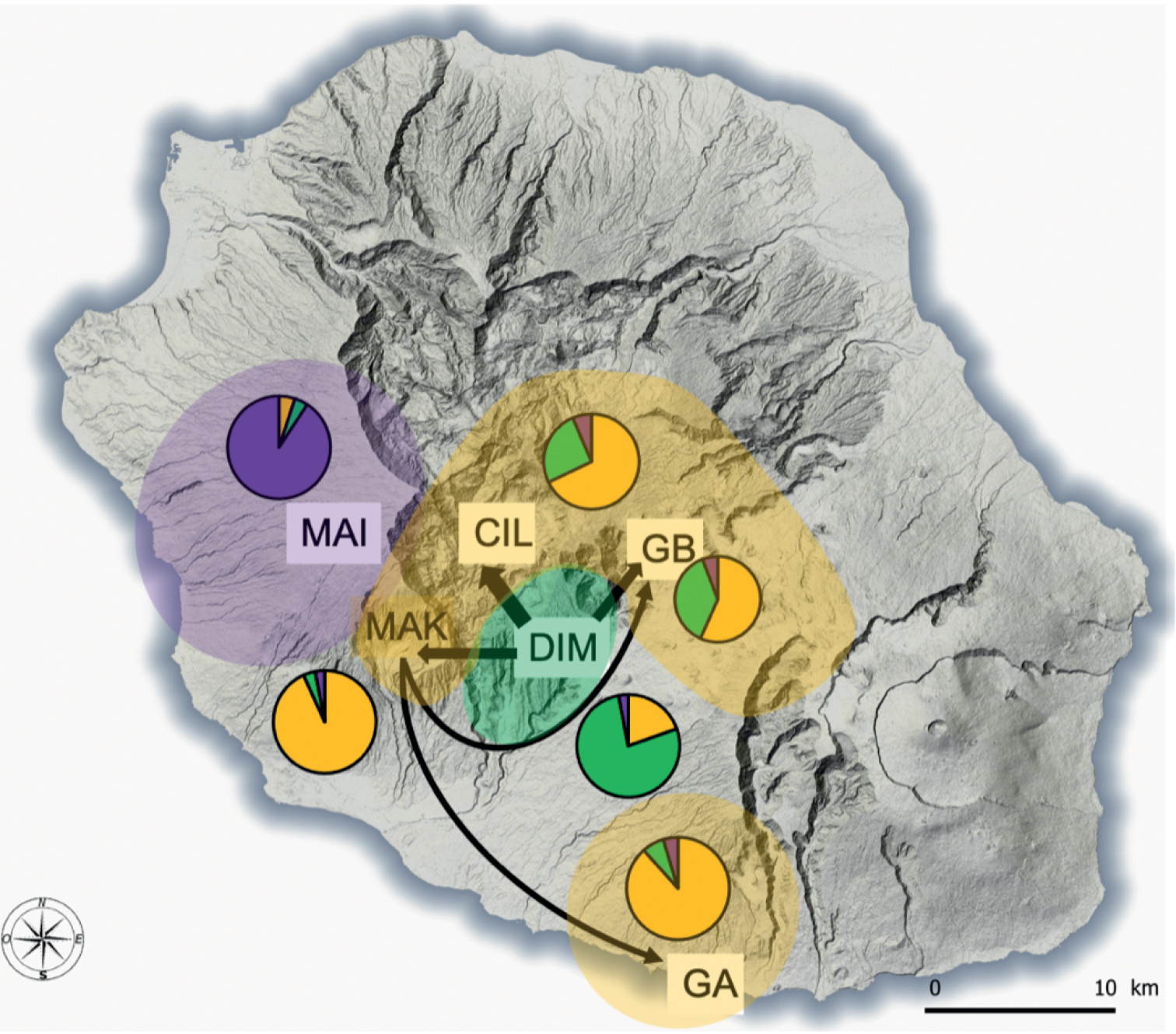
Distribution of microsatellite clusters based on Bayesian clustering analysis using STRUCTURE (pies) and Geneland (coloured areas) and map of the migratory pathways suggested by BIMr and BayesAss (black arrows, the thickness is proportional to the amount of gene flow) of the feral cats (N = 158 individuals) in Réunion Island, 2015-2016. Area codes: MAI for Maïdo, CIL for Cilaos, MAK for Makes, GB for Grand Bassin, DIM for Dimitile and GA for Grande Anse. |