|
||
|
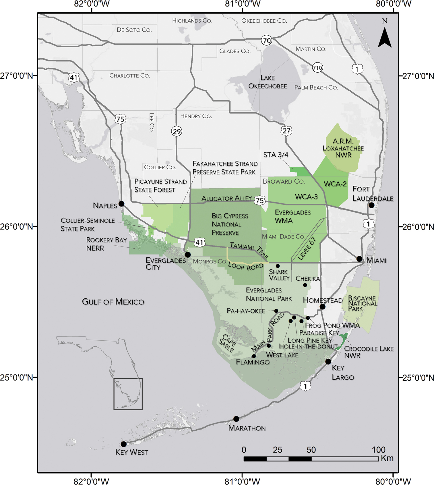
General Burmese python (Python molurus bivittatus) research areas across southern Florida (inset, black box). Primary research areas are indicated by green shaded polygons or black dots. Large black dots indicate major cities and gray lines indicate major roads; the beige line indicates Loop Road (unpaved). Levee-67 continues into ENP (L-67X). Abbreviations include Arthur R. Marshall Loxahatchee National Wildlife Refuge (LNWR), Everglades and Francis S. Taylor Wildlife Management Area (Everglades WMA), Water Conservation Areas (WCA 2 and 3), Stormwater Treatment Area 3/4 (STA 3/4), Pa-hay-okee Road (Pa-hay-okee), Hole-in-the-Donut Restoration Area (Hole-in-the-Donut), Frog Pond Wildlife Management Area (Frog Pond WMA), Rookery Bay National Estuarine Research Reserve (RBNERR), and Crocodile Lake National Wildlife Refuge (CLNWR). Faint gray lines are county boundaries. |