|
||
|
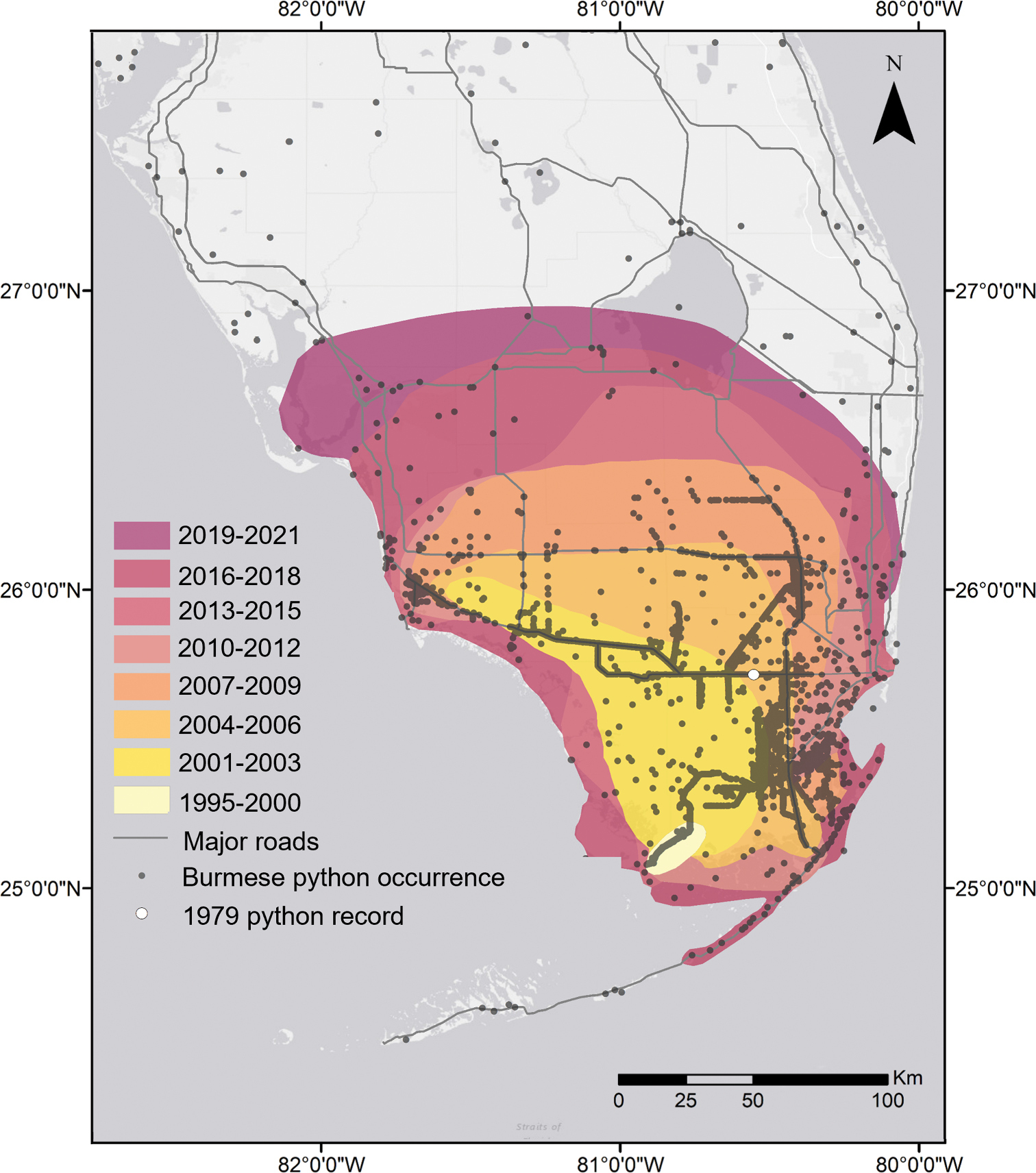
Geographic spread of Burmese python (Python molurus bivittatus) records in southern Florida between 1979 and 2021. Occurrence records were obtained from a large geospatial database of invasive species reports (Early Detection & Distribution Mapping System, EDDMapS 2018) submitted by both researchers and the public. Records are classified as ‘verified’, ‘credible’, or ‘possible’, and colored polygons for each timespan are general estimates delineated using the highest densities of verified records. Polygons from 1995 through 2009 are modified from Dorcas and Willson 2011. Thus far, verified records north of Lake Okeechobee cannot be confidently attributed to the southern Florida population and may represent newly escaped individuals. The area represented by the outer polygon (2019–2021) encompasses all other polygons and represents an area of approximately 29,900 km2. The purpose of this map is to illustrate the chronology of python removals across southern Florida and represents the best professional estimate of the invasion front, which is not exact and will change over time. |