|
||
|
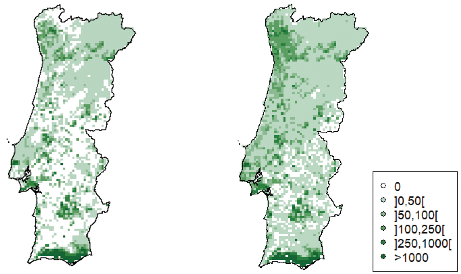
The spatial representations of the estimated citrus trees density (number of trees/km2) in Portugal. The left map represents the estimation of citrus trees density in Portugal, based on the area of citrus orchards reported in the last agricultural census (INE 2021), while the right map was obtained using both the data from the agricultural census (INE 2021) and our estimates of the number of citrus trees in urban and peri-urban areas, based on Google Street imagery. |